About the Project
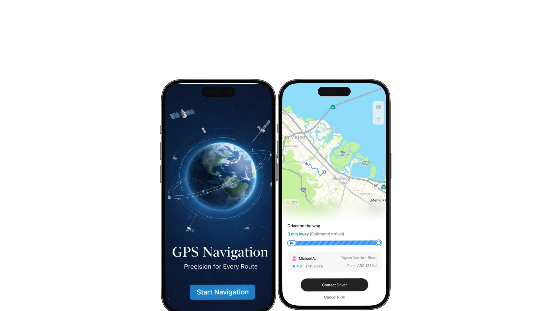
"GPS Sentinel" is a high-stakes mobile geospatial application developed as a proprietary tool for internal tracking and geographical data visualization. The project's core mission was to bridge the gap between orbital satellite data and on-the-ground decision-making. We transformed a complex mapping requirement into a high-performance mobile interface that allows for real-time asset monitoring and environmental mapping across diverse international territories.
The Business Challenge
01 Geospatial Latency: Handling high-resolution map data on mobile devices often leads to significant lag; the app required a specialized rendering engine to ensure smooth zooming and panning.
02 Edge-Case Connectivity: Internal teams often operate in remote zones with intermittent 4G/LTE; the system needed to utilize a robust SQLite backbone for offline map caching and data persistence.
03 Data Accuracy vs. Security: As a non-public, internal-use tool, the application needed to maintain hyper-accurate positioning while ensuring that sensitive movement logs and geographical data remained within a secure, encrypted cloud environment.
04 Cross-Border Utility: The platform needed to handle multi-regional mapping data — from India to the Middle East — without losing the granularity required for industrial-scale navigation.
Strategic Roadmap
High-Utility Mapping UX: We centered the UI around a "Zero-Friction Visualization" narrative, utilizing a clinical, data-focused design that prioritizes map real estate and intuitive zoom controls.
Technical Stack Optimization: Leveraged a hybrid Java-Firebase architecture to ensure real-time location pings while offloading heavy graphical tasks to localized SQLite storage.
Internal Security Firewall: Built the application as an enterprise-only ecosystem, ensuring that proprietary assets and geographical markers are protected by institutional-grade authentication.
Scalable Asset Tracking: Designed a modular backend capable of transitioning from single-user mapping to a comprehensive fleet-management dashboard without requiring a code overhaul.
Key Features
- Satellite-to-Mobile Integration: A high-speed interface that visualizes complex orbital positioning data into simplified, actionable map markers.
- Dynamic Zoom & Pan Engine: A specialized UI component that allows users to toggle between macro-regional views and micro-street-level details instantly.
- The "Offline-First" Buffer: A sophisticated SQLite implementation that caches map tiles and telemetry data, allowing for uninterrupted operation during signal drop-outs.
- Real-Time Telemetry Sync: An automated Firebase-driven system that pushes location updates and geographical notes to the central command hub with millisecond latency.
The Results
- →Operational Precision: Successfully transitioned the internal team from traditional GPS handhelds to a modern, integrated mobile solution, increasing data reporting speed.
- →Logistical Security: Established a "Fortress" environment for internal data, eliminating the risks associated with using public, third-party mapping APIs.
- →Enhanced Intelligence Velocity: Built a platform that allows for rapid geographical assessments, significantly shortening the time required for site surveys and asset deployments.
- →Technical Future-Proofing: Delivered a robust, Java-based architecture capable of supporting future integrations with IoT sensors and advanced telemetry hardware.
Similar portfolio

Lansdowne Partnership: Redefining the Irish Residential & Commercial Landscape
Explore Project
RTTPPA Mobile App: Hospitality Logistics ERP on the Go
Explore Project
Midland Conveyor Services: Engineering the Pulse of Global Industry
Explore Project